

The Original Shoreline
THE ORIGINAL SHORELINE is a long-term public space
and digital storytelling project that traces an educational, historical
and natural route along the original shoreline of Cape Town.
Over the centuries, geographical shifts, human events and land development have obscured
the historical shoreline. This has influenced the city’s history and reconfigured the shape of
the land that meets the water. And yet, it is a line rich with history containing layers of
stories that have long been suppressed, overlooked, or left to lie in dusty drawers
and family folklore.
The project was conceived as a way to mark the original shoreline, from the first making of
the land to present day. It seeks to use the power of storytelling and authentic historical
accounts to expand into a more cohesive, more inclusive history of Cape Town.
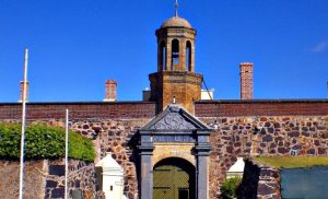
In the first phase, the shoreline is revealed in a physical route from The Castle of Good Hope,
through the Cape Town CBD, to the V&A Waterfront, taking in notable landmarks along the way.
The landmarks reflect the historical, architectural, maritime,spiritual, community, environmental
and slavery histories that shaped the city’s original shoreline.
Check out the Landmarks page for more detail, and look for the blue ceramic markers
along the physical route, starting at the Castle of Good Hope, moving
through the Cape Town city centre and ending at the V&A Waterfront.
Download the VoiceMap and use it as you walk the route, immersing
yourself in the sights and sounds of the original shoreline.
The shoreline will come to life with stories, anecdotes, historical accounts
and contemporary explanations. If you want to know more, have a story to tell,
or want to get involved in the Original
Shoreline project, get in touch.
While the Cape Town Heritage Trust has initiated this project, is
it for everyone to own and contribute.
ORIGINAL SHORELINE LANDMARKS
– powered by –
Cape Town Heritage Trust

– our partners –


